River Levels
Building a park along the Ohio River and one that embraces flooding requires a lot of thought and planning. However, while we are not able to control flooding, we can monitor it so that you can plan a trip to Origin Park to kayak, canoe or fish.
FIRST STEP- Watch the instructional video.
SECOND STEP- Click on this link to view River levels
https://water.noaa.gov/gauges/mlpk2
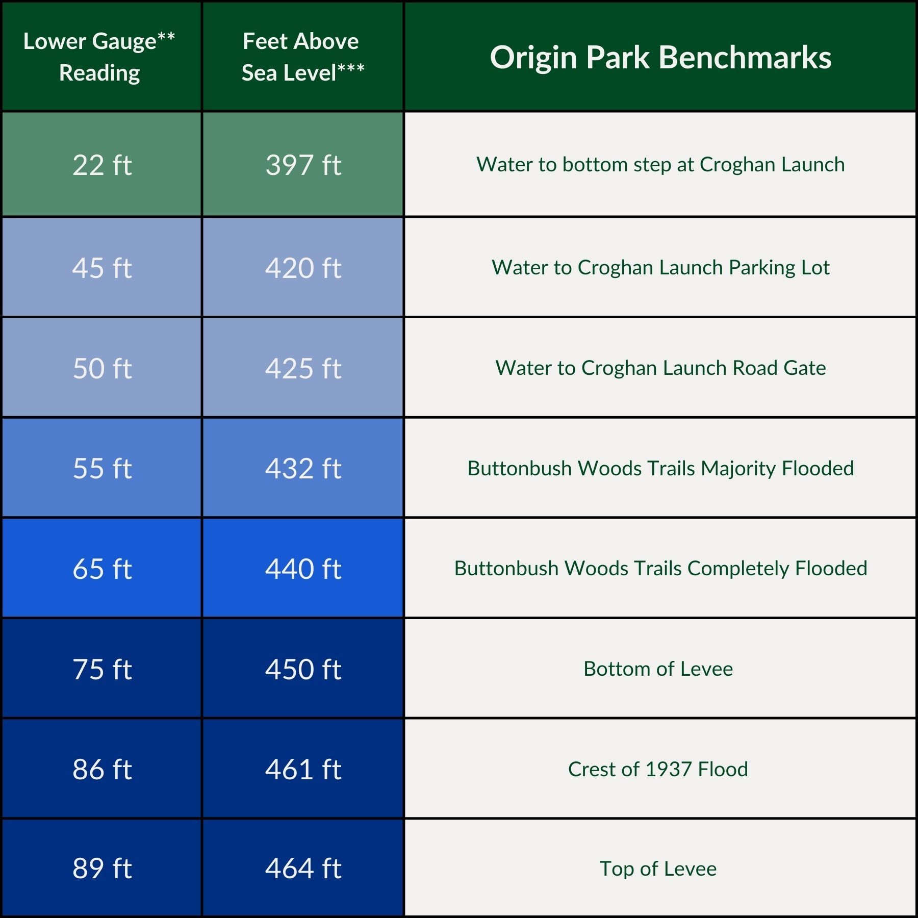
Once there, simply compare the levels to areas inside Origin Park using the chart below.